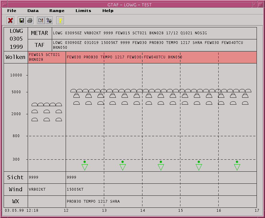
Written in the Java programming language, this software can be used to quickly retrieve the most recent METAR and TAF messages from a database server for a certain location. A batch feature allows to define a main location (or airport) and several sub-locations (or airports) for which the METARs and TAFs are requested in a row. With only a few mouse-clicks, the program creates ready-to-print charts for each location where the main location is printed on the first page and two sub-locations are summarized on the following pages.
The features can be summarized as follows:
| Automatical visualization of most current METAR and TAF messags. | |
| Charts can be printed | |
| Definition of a main location and one or more sub-locations. | |
| In a special batch mode, data for all locations can be automatically requested from the database in a row and all charts can be printed to get a quick overview of the main station and all defined sub-stations. | |
| The time range (from/to time) for TAF visualization can be arbitrarly chosen. | |
| Arbitrary limits can be set for certain METAR/TAF values. If the limits are exceeded, the respective field is highlighted in the chart. | |
| Runs on all computer platforms which support the Java2 run-time environment, for example: Windows, Sun/Solaris, Compaq/Digital Unix, IBM/AIX, Linux etc. |
For more informations, please contact us.
The following image shows an example for such a chart.